Where’s the water?
Believe it or not, a creek used to run right through this park. It was enclosed in a concrete tunnel in the mid-20th century. When you’re standing in the park you can probably guess its original contours. (Hint: start from the storm drain in the street.) While channelizing the creek mitigated flood risk in Mount Rainier, now whenever there’s a storm, the waterfall and its pollutants flow directly into the Northwest Branch of the Anacostia River.
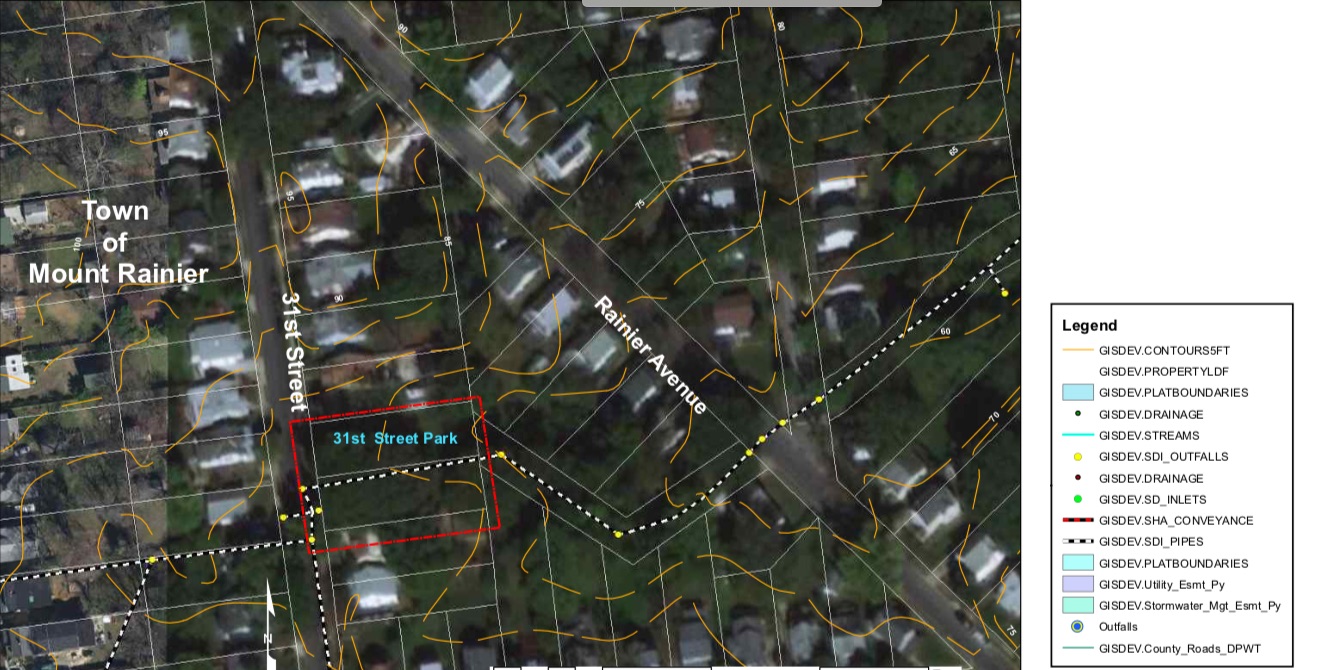
This map (from Maryland Department of Public Works and Transportation) shows where the underground creek runs through the park:
Efforts are underway across the country to “daylight” or return channelized creeks like this one to their natural settings. A creek’s natural plantings help to filter out pollutants before it reaches larger waterways. Maybe someday we can “daylight” the creek in our park.
Find it and keep it!
- Capture it in swales. There are six swales in the park. This is how a swale works:
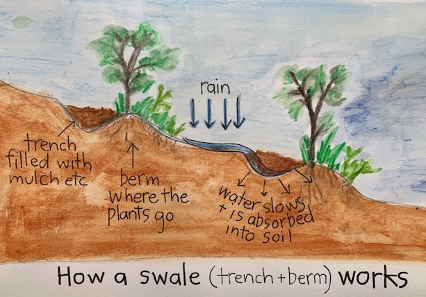
Drawing by Kathy Shollenberger - Look for the lowest spot and make a rain garden. The Alliance for the Chesapeake explains the why and how here: Rain Gardens.
- Save it in a rain barrel. Here’s a great little film about rain barrels from the USDA: People’s Garden: “Why Use Rain Barrels? – Helpful Tips.”